 Geographical Information System
We create productivity software for our client that incorporates mobile app and web development.
Geographical Information System We create productivity software for our client that incorporates mobile app and web development.
with the Geographic around us.
Hundreds of thousands of organizations now-a-days are virtually involved in the field of GIS to make maps to communicate, share information, perform analysis and solve complicated problems. Industries like engineering, planning, transport, management, logistics, insurance, telecommunications and business etc. apply GIS to enable location-enabled services due to which GIS is become the base model to be used in their systems.
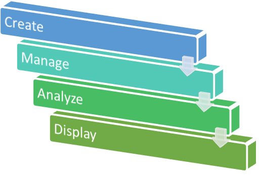
GIS is a 4-Step Process:-
Lorem ipsum dolor sit amet consectetur adipisicing elit. Neque, eveniet earum. Sed accusantium eligendi molestiae quo hic velit nobis et, tempora placeat ratione rem blanditiis voluptates vel ipsam? Facilis, earum!
Lorem ipsum dolor sit amet consectetur adipisicing elit. Neque, eveniet earum. Sed accusantium eligendi molestiae quo hic velit nobis et, tempora placeat ratione rem blanditiis voluptates vel ipsam? Facilis, earum!
We can help you to transform your ideas and vision into reality. Design and develop your custom web solution at affordable costs.
Copyright© 2019 Triline Infotech. All right Reserved.
 PHP Development
 ODK
Development
ODK
Development Tech Consultation
 Cloud Management
 Drupal Development
 Yii2 Development
 Mobile App Development
 Api/3rd Party Integration
 Devops
 Business Analysis
 .Net
.Net Agile
Agile Geographical Information System
 Infrastructure Management